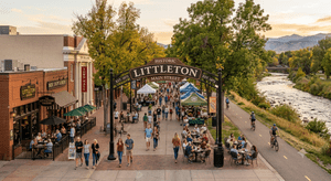
Littleton, Colorado: A Full Map Tour
Where should you actually live in Littleton, Colorado? We put together a real Google Maps walkthrough of the city, boundaries, neighborhoods, price points, commute times, even how easy it is to get to the airport or up into the mountains on a weekend. Here's the full breakdown.
Prefer to read than watch? Here's the map, in words.
Where Littleton Sits
Littleton sits southwest of downtown Denver, right at the base of the foothills. It's long and narrow rather than sprawling in every direction, which means no matter where you land here, you're rarely far from the rest of the city. You'll notice more rolling terrain and elevation than flat downtown Denver, along with easy access to the mountains to the west and a short trip north into the city.
Six Neighborhoods, Six Different Price Points
Historic Downtown — the walkable core along Main Street, close to light rail. One of the fastest-growing areas price-wise, homes here trade around $725,000.
Ken Caryl — a large, established community with real range. The Ranch and Plains side runs in the mid-$600,000s, while North Ranch custom estates push well over a million. Nearly 5,000 acres of shared open space and private trails come with it.
Columbine — established and tree-lined, core neighborhoods run high $500,000s to high $600,000s, though pockets like Columbine Knolls South push past $900,000.
Roxborough — dramatic red rock scenery, homes from $600,000 up to $5 million, median around $800,000 to $900,000. The honest trade-off: a longer commute, closer to 40 minutes into downtown Denver.
Bow Mar — a small, private, gated lake community and the top of the market here, median sale prices around $2 million.
Sterling Ranch — new construction at the southern edge, a master-planned community with a clubhouse, pools, and pickleball courts. Prices run mid-$600,000s to mid-$700,000s.
Getting Around: Commute, Airport, and the Mountains
Most of Littleton runs 20 to 30 minutes into downtown Denver outside of peak hours, with light rail access if you'd rather skip the driving. Denver International Airport is about 35 miles away, typically a 40 to 45 minute drive via E-470.
One thing a lot of people don't realize about Littleton specifically: you've got two real routes up into the mountains without ever touching downtown Denver traffic, C-470 west into I-70 toward Idaho Springs, Georgetown, and Summit County, or Highway 285 south through Conifer and Bailey.
Where to Eat
Olde Towne Tavern is a local institution for pub fare, Farm House at Breckenridge Brewery sits right on the South Platte River, Cafe Terracotta offers an upscale spot in a historic home, and Romano's is a long-standing favorite for Italian.
Daily Life
The South Platte River Trail runs right through town for biking, running, and walking. Hudson Gardens offers a genuine botanical garden and event venue, and Historic Downtown hosts farmers markets and community events year-round.
Ready to Explore Further?
Not ready to talk? No problem. Check out our Littleton Communities page, get the honest pros and cons of living here straight from local residents, see our breakdown of Littleton's top 5 neighborhoods by price, or come along for a real day in Littleton.
A Note on Our Data
Prices reflect market conditions at the time this video was filmed. Market conditions change, if you're reading this well after publication, reach out and we'll pull current numbers for you directly.
Thinking about a move to Littleton? My wife Sandy and I have been helping people move to and around the Denver foothills since 2011. We can dive deeper into whichever of these neighborhoods caught your eye.
📧 Tim@JonesTeamColorado.com
📞 (720) 314-8462
📅 Book a free, no-obligation consultation
Tim Jones, REALTOR® FA100046509 | Sandy Jones, REALTOR® FA100035464 | Jones Team Colorado | eXp Realty